BREVARD COUNTY · CENTRAL FLORIDA
Brevard County · Greater Central Florida
THE NEIGHBORHOOD
Where the aerospace payroll and the mainland Indian River pattern set the residential rhythm.
THE STORY
Port St. John is a census-designated place, not a city, and residents have voted to keep it that way. Five of them mounted an incorporation effort in 2002 and it was defeated at the ballot that November. So Port St. John remains unincorporated Brevard County, governed from Viera rather than from a town hall of its own.
It sits in northern Brevard between Titusville and Cocoa, filling the strip between U.S. 1 on the east and Interstate 95 on the west. That is a genuinely useful position: Kennedy Space Center payrolls are north, the Cocoa and Merritt Island employment is south, and both are a short run on either road.
The community organised itself around infrastructure. In 1992 the Port St. John Homeowners Association acted as liaison between residents, county staff and contractors during the widening of Fay Boulevard to four lanes, which is still the main east-west spine. Grissom Parkway carries the residential traffic of Port St. John and neighbouring Canaveral Groves north, and it is the road most commuters actually use.
The 2020 census counted 23,474 residents, close to double the 2010 figure, which is why the housing stock reads younger here than in the older river towns on either side.
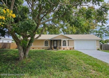
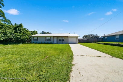
The inventory is largely 1980s through 2010s suburban single-family construction on conventional lots, with newer subdivisions on the western edge toward I-95 and older sections closer to U.S. 1. Values sit below Suntree and below the barrier-island towns.
Port St. John is served by Brevard Public Schools. For buyers the case is newer suburban stock and dual highway access at a lower entry point than most of Brevard, with the trade-off that county services come from Viera rather than a local government.
Frequently Asked
Port St. John is a census-designated place, not a city, and residents have voted to keep it that way: an incorporation effort by five residents in 2002 was defeated at the ballot that November. It sits in northern Brevard between Titusville and Cocoa, filling the strip between U.S. 1 on the east and Interstate 95 on the west.
The position is genuinely useful: Kennedy Space Center payrolls are north, the Cocoa and Merritt Island employment is south, and both are a short run on either U.S. 1 or Interstate 95. Grissom Parkway carries the residential traffic north and is the road most commuters actually use. Fay Boulevard is the main east-west spine.
What trades here is largely 1980s through 2010s suburban single-family construction on conventional lots, with newer subdivisions on the western edge toward I-95 and older sections closer to U.S. 1. The 2020 census counted 23,474 residents, close to double the 2010 figure, which is why the stock reads younger here than in the older river towns on either side.
That varies by subdivision here. Port St. John is largely 1980s through 2010s suburban single-family construction on conventional lots between U.S. 1 and Interstate 95, with Fay Boulevard as the spine, and the newer subdivisions sit on the western edge toward I-95. Tell us which one and we will verify.
Port St. John is a census-designated place, not a city, and residents voted in 2002 to keep it that way, so no city rate applies. That is a real part of the lower entry point here. The trade is that county services come from Viera rather than a local town hall.
Ask to join our buyer list for Port Saint John alerts.
Build era sets the inspection, since the stock runs from the 1980s through the 2010s: establish the year, then inspect roof, panel and systems to it. Newer subdivisions on the western edge toward I-95 may carry association documents worth reading. Because governance comes from Viera rather than a local town hall, confirm county service levels and any pending road or drainage work before you commit.
The youngest stock and the interstate commute are the newer subdivisions on the western edge toward I-95. The older sections closer to U.S. 1 are the entry point and sit nearest the river corridor. Addresses along Grissom Parkway serve the Kennedy Space Center commute north, and Fay Boulevard proximity trades convenience against sitting on the main spine.
The community fills the strip between U.S. 1 on the east and Interstate 95 on the west, so the river corridor is close on one side and the wider county open space on the other. Grissom Parkway runs north through the neighboring Canaveral Groves rural land toward the Kennedy Space Center area.
SPEAK WITH AN MCR AGENT
Our agents live and work in Central Florida. They'll know which streets to walk, which homes are coming off-market, and which numbers will actually pencil out.
WORTH EXPLORING